During my studies of Book of Mormon
geography I have had a number of significant insights which have help
me develop my theory of the book's geography. The following are a
summary of these insights. Some are still tentative, but most are
solid. I have not listed the related references, but if any of you
has a specific request, please email me and I will send them to you.
Regarding the Jaredites:
The Jaredites traveled eastward through
Asia until arriving at the coast of the Pacific. Their intermitant
travel lasted for over 100 years.
The main Jaredite settlement in the New World was Moron
which I feel was near the Bay of Fonseca.
Over the years, various groups of
dissident Jaredites separated from the original group forming separate ethnic groups.
About 900 BC the Narrow Neck of Land
was blocked by an infestation of poisonous snakes. After about 400
years King Lib finally destroyed the snake infestation, and the land
southward was opened, but not for settlement. It was reserved for
hunting. As a result, no Jaredite cities were built south of the
narrow neck.
King Lib built a great city at the
place where the “sea divides the land.” This feature is located between
Zapatera Island and the mainland on Lake Nicaragua.
The Jaredite destruction occurred about
200 BC; later than is generally supposed.
Jaredite-Nephite geography is connected
at four locations, The Narrow Neck of Land, the Hill and Land of
Cumorah, the Land of Desolation, and the city of Moron.
The Jaredites built pyramids, or
ziggurats, in the Sumerian style.
Regarding the Nephites:
Learning that the ship that the Lord
designed for Nephi was a catamaran. This design was copied by Hagoth
and it was passed on to the Polynesians.
Identifying the Istmus of Rivas in
Nicaragua as the Narrow Neck of Land.
Identifying the site of Barriles in
western Panama as the former city of Nephi.
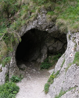
Identifying Las Lagunas in western
Panama as the Waters of Mormon.
Realizing that the Nephites primarily
built with wood, while the Jaredites built their ceremonial centers
with stone.
Realizing that the unique Costa Rican
stone balls were Lamanite imitations of the Liahona, a sort of totem.
Realizing that finding placer gold
deposits on the coast, where the Nephites landed, is unique to the
Osa Peninsula in Costa Rica, and Nome, Alaska.
Learning of the Pacific Counter Current
as the means that the Nephites used to come eastward to the Americas.
This current flows directly to the Pacific coast of Costa Rica.
Discovering that the Judgements seats
used by the Nephite judges were stylized metates which were buried
with their owners upon death. These artifacts are unique to Costa
Rica.
Realizing that the so called Mulekites
had been subservient to the remnant Jaredites in the land northward,
had adopted their language, had lost their original Hebrew, and had
adopted their culture. This culture included weights and measures,
religion, a preference for monarchy, and a high regard for gem
quality jade.
Learning that the jade traditon was
preiminent among the Nephites while the Lamanites preferred gold. In
Costa Rica the jade preference is manifest until about 500 AD when it
shifts to gold following the elimination of the Nephite culture.
Realizing that the majority of the
lower judges among the Nephite/Mulekite group were Mulekites.
Realizing that the Mulekites were of
Judah and that the Brass Plates specified that the right to rule
pertained to Judah (at least in the Old World). This resulted in
considerable conflict.
Becoming aware of the Mulekite
Connection and the influence that the majority population of the Jaredite
tainted Mulekites had upon the Nephite culture.
Realizing that Christopher Columbus was
the fulfillment of Nephi's prophecy and that he only made land fall
in Honduras, Nicaragua, Costa Rica, Panama and Venezuela. Therefore
the fullfilment of the prophecy would have to be among the peoples of
one of those countries.
The notion is prevalent that the
Spaniards destroyed most of the Indian records containing their
histories. While they did burn many of these records, the Indians
mainly relied on oral traditions and used the written records as
mnenomic devices to remind them of the stories and events. Thus even
though the physical records may have been destroyed, they all lived
on in the minds of the trained scribes, at least for one generation.
Many of these histories were later recorded but in general are
discounted by the scholars.
The Nephites did not have an areal
concept of geography. They saw everything from ground level.
Mountains were separating lines, and valleys and river basins were
seen as lands, great and small.
The Book of Mormon uses “up or down”
to describe the travel or the relation of one place to another. This is
very evident in mountainous places such as Costa Rica.
Captain Moroni fortified the Nephite
cities with mounds of earth topped by a palisade of timbers. This
was surrounded on the outside by a deep trench or dry moat. The
remnants of each of these cities should be easily identified using
infrared aereal photography.
The directions given in the Book of
Mormon should be precise and related to our modern concept of
direction, as do the Old and New Testaments. They were not changed by
Indian tradition, or if they had been would have been translated to
our understanding during Joseph Smith's translation process.
The Brass Plates were written in the
revised or reformed Egyptian language. Nephi and Lehi had learned
this shorthand language, could read and write it, and it became the
pattern for all their subsequent recording.
The Nephites had other writings which
were not on metal plates. Many, if not all, Nephites were literate
and had copies of some or all of the scriptures. These were written
on some kind of perishable material and were probably in the Reformed
Egyptian. This means that the children were probably taught and
instructed.
The Nephite climate was mild and
temperate. They likely were able to grow two or more crops each
year.