For many years it was assumed by critics of the Book of Mormon that Nephi's description of the Land of Bountiful in 1st Nephi 17 was false and impossible. This was used as an argument against the veracity of the book. How could there be such an environment in all of the bleak and forbidding desert of Saudi Arabia.
But now we know, thanks to the discoveries of men such as Warren Aston, that there are such lands on the coastal plains of Oman. These things were completely unknown to even the learned at the time of Joseph Smith. This is one of the proofs of the book that are gradually accumulating as more discoveries are made as the results of diligent searching.
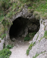
I have decided to assemble a series of photos from Google Maps that illustrate the lush environment of modern Bountiful. Most of these are from populated places (Dhalkut and Rayhkut) to the east and west of what has been identified as Bountiful or Khar Kharfot
 |
This is the immediate area around Bountiful. The red dot is Kharfot at the mouth of Wadi Sayq. The wadi can be
| seen as the dark line trending westward. The diagonal line in the south west corner is the Yemen/Oman border. You may be able to distinguish the green tint along the coastal lowlands that is the vegetation resulting from the monsoon storms that bring moisture to this otherwise barren land. Below is a shot of the mouth of Wadi Sayq looking eastward. |
 |
| This photo shows the lush vegetation near Dharkut westward along the coast toward the Yemen border. Trees, grass and shrubs are abundant. |
|
 |
| Near Dhalkut. Showing lush vegetation and precipitous drop down to the ocean. |
 |
| Another shot near Dhalkut with steep cliffs and ocean side. |
 |
| Inland from the sea showing lush vegetation. |
 |
| Near Dhalkut showing coastal topography and seashore. |
 |
| Pasture land near Dhalkut. |
 |
| Rugged coastal area near Dhalkut. |
 |
| Cliffs and sea Dhalkut area. |
 |
| Pasture land in Dhalkut region. |
 |
| A short way inland from the coast one is back in the harsh desert climate of interior Saudi Arabia. |
 |
| Upper Wadi Sayq showing desolate landscape. |
 |
| Highway in Dhalkut region. |
 |
| Scenic view near Dhalkut. |
 |
| Rugged coastline Dhalkut area. |
 |
Areal view of Rayhkut Beach east of Khar Kharfot.
|
Rugged coastal area near Rayhkut.
 |
Omani Boabab tree showing large size of some trees in area.
|
 |
| Inland view of mouth of Wadi Sayq. |


No comments:
Post a Comment