 I have often wondered about the routes the Lamanites would have used to invade the northern Nephite lands. Would some of these same routes exist, even today, as highways, country roads, or trails? Apparently many of the ancient trail systems have endured over the millenia. The archaeologist Payson Sheets, in a study in the Lake Arenal area of Costa Rica, has found that the ancient trails persisted in the same locations for thousands of years. Even after having been obliterated by volcanic eruptions, they were subsequently re-established, along the same routes, by succeeding generations. Would this be true of the old Lamanite trails?
On numerous occasions the Lamanites crossed over the “narrow strip of wilderness” to invade the lands of the Nephites. My impressions are that this was mainly on the eastern or central portions of the narrow strip. The Lamanites would usually attack Zarahemla itself, some of the nearby cities, or the area around Moroni on the east sea.
Only a few instances of them invading from the south, along the coast of the west sea, are mentioned. Perhaps this means that the western route was more difficult. On one occasion they apparently moved north along the shore of the east sea to invade the Land of Moroni, but these coastal routes seem to be the exception.
As you are probably aware from previous blogs, I believe that the Nephite lands were mainly located in northern Costa Rica. In a recent review of my Costa Rican topographical maps of the area I have come across the routes that I believe would have been the main invasion routes for the hostile Lamanites. Some of them are even currently marked as existing trails. This would make sense as the ancients undoubtedly found the best routes and these were preserved over the passing years by succeeding generations.
The Costa Rican Central Valley, and its eastern extension in the Reventazon River Valley,would have formed the main Nephite habitation area immediately north of the “narrow strip of wilderness.” “Wilderness,” as used in the Book of Mormon, usually refers to an uninhabited mountainous region.
In Costa Rica there is a chain of mountains running south from the Central Valley. These mountains form a large T with the top of the letter running east and west from the Pacific to the Caribbean. The stem of the T is the Talamancan Mountain chain which forms the continental divide of southern Costa Rica.
The principal Lamanite lands and cities were in the large valley of the Rio General to the west of the Talamancan mountains. The rest of the mountainous “south wilderness” would have been lightly settled by nomadic bands of scattered Lamanites.
To cross over the “narrow strip of wilderness,” from the principal Lamanite lands into Nephite lands, they would follow a mountain ridge up over a pass at the junction of the T, then cross over the mountains down into the wilderness side of the Nephite lands. I will illustrate this with a series of Costa Rican topographic maps.
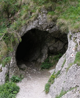
 |
| Chirripo Pass |
To follow this discussion, you will need some topographic maps of Costa Rica. These would cost $15 a piece if bought over the Internet. If you have access to a major university library, they may have copies available for your use. Fortunately, however, the Costa Rican government has made these maps freely available over the Internet. You can access them here. (These links are now dead. The maps can be accessed at this new site but will cost you a one time fee of $10)
We will be using the following maps which are included below (links are dead but I have posted the actual maps at the end of the blog):
 |
| Index map Click to enlarge |
Beginning on the San Isidro map, a trail starts at the town of San Gerardo (this is northeast of the city of San Isidro at the north end of the Lamanite valley). This trail goes up and over the continental divide (passing through the Cuerici map) to the Caribbean drainage (the Chirrip map), thus providing a route to cross the mountain barrier. The trail goes up the ridge called Fila Palmito Morado (on the San Isidro and Cuerici maps). At this point the map lists the trail as “Camino de los Indios” (Indian road). It goes up to a pass (called “Paso de los Indios”) on the divide at about 9500 feet elevation and then crosses over into the headwaters of the Rio Chirripo Atlantico, and then downstream to Chirripo Arriba (on the Chirripo map). From Chirripo Arriba one trail leaves the river and crosses over a pass to the north and down into the Pacuare River drainage (Pejibaye map). From thence to Porvenir at the headwaters of the Pacuare River. From Porvenir the trail leads northwest along a flat ridge to Cerro Mirador, then down the Rio Atirro valley to Esperanza.
There was also probably a trail west from Cerro Mirador (still on the Pejibaye map) to Cerros Catarata, then northwest to Cerro Linda Vista. There a trail drops down into the Pejibaye River Valley. This was the main route from the city of Zarahemla to the city of Manti. This trail goes up the Pejibaye River to Taus, then up the Taus River valley to Selva and Tausito.
From Tausito the trail goes over a low pass (Tapanti map) and drops down into the valley of the Rio Grande de Orosi River (headwaters of the Sidon) at Tapanti. I believe that this small valley was the site for the famous battle between the armies of Captain Moroni and Zerahemnah recorded in Alma 43-44. A short ways down river you arrive at the modern town of Orosi, which I believe was the site of ancient Manti.
From any of the above places the Lamanites could also follow the valleys down to the main Reventazon River (or the Sidon) and attack the capitol of Zarahemla at what is now Turrialba (Tucurriqui map).
Backing up to the trail at Chirripo Arriba (Chirripo map), there was another trail that went downriver from there to Chirripo Abajo. I had always envisioned that there was a trail that followed the Chirripo all the way to the coast, but apparently not. It appears that the river gorge is too rough for regular travel. However, there is another trail from Chirripo Abajo which goes over the mountains to Moravia and then down the Tuis River Valley which flows into the Reventazon River just opposite Turrialba (Tucurriqui map). This would have been the probable route of the Amalicite-Lamanite invasion described in Alma 2
Also beginning at Moravia there was probably a trail which followed the ridge north of the Moravia River east to the mouth of the Chirripo River (Barbilla map) where it flows out onto the coastal plain. I envision this plain at the mouth of the Chirripo as the former site of the city of Nephihah. This may have been the route used by the Lamanites when they captured the city of Nephihah as described in Alma 59:5-5.
There was a network of trails that ran east-west through the mountainous wilderness from Nephihah to Manti (Barbilla, Pejibaye and Tapanti maps). This trail network probably extended westward from Manti to the cities of Zeezrom, Cumeni, Judea and Antiparah, however, I haven't studied these cities enough to locate them or their trails exactly. From Antiparah the trails extended westward to an unamed city on the coast of the west sea.
Having a knowledge of the trails system of the Lamanites helps to clarify and better define Book of Mormon geography.
 |
| Tucurriqui |
 |
| Chirripo |
 |
| Cuerici |
 |
| Pejibaye |
 |
| Matama |


"Having a knowledge of the trails system of the Lamanites helps to clarify and better define Book of Mormon geography."
ReplyDeleteYou failed to first construct an internal/mental map. The above summation of yours is flawed. To reconstruct the geography by what physically exists is a waste of time and will further nothing but your arrogance, no offense.
Want to construct a fresh model then be consistent and stop incorporating other people's presumptions.
1. Extract time distances first. If you had done that you would have realized Costa Rica is infeasible.
Here's a hint: time distance from Bountfiul on the north to Manti, i.e. River Sidon head on the south is known.
2. You lack plains between the East and West Seas.
3. Distinct wilderness areas are lacking, i.e. it's not everywhere!!
Hint: Hermounts.
4. Mountains are ALWAYS associated with the wilderness and not the reverse.
What voice do you think is prompting you to pursue this nonsense? Will it prove how prophecies were fulfilled or is it adding confusion?
So far you have not heeded advice by the experts, nor respected official church statements, nor demonstrated how the lands are identified through fulfilled land prophecies.
This comment has been removed by the author.
ReplyDeleteAnonymous,
ReplyDeleteFrom your comments I can see that you have not taken the time to read the rest of my material, otherwise you would know that those questions and criticisms have been addressed elsewhere