The Richardson Pan-American Highway Expedition is perhaps one of the greatest automotive stories of all time. In scope and magnitude it surpasses those pioneer automobilists that first crossed the United States at the turn of the century The Richardson Expedition crossed not only this country but encompassed the area spanning two continents-crossing trackless wilderness, endless mud. un-chartered territory and obstacles of every sort that Mother Nature could throw against them. So begins the story in the 1982 Plymouth Bulletin. See also a video documentary of the journey https://www.youtube.com/watch?v=1D-5UT4BHE0
In considering travel, as it relates to Book of Mormon geography, it is often good to review early accounts of travel in a given area. Today I would like to review an account of one of the first automobile trips from North America to the tip of South America. This was undertaken by Sullivan Richardson in the 1940s. The excerpts and photos are from the article in the bulletin, and these in turn were taken from Richardson's book titled Adventure South (now out of print).
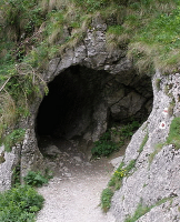
The section I am interested in reviewing is that part of their trip from Rivas, Nicaragua, to San Jose, Costa Riva. For those interested in reading the complete account, refer to the Plymouth Bulletin article. The point I would like to emphasize is that the route Richardson took (from Rivas along the shore of Lake Nicaragua to the Sapoa River, and then up the Sapoa River valley to the city of La Cruz) is the same route that was used anciently, was used in 1940, and is still in use today. This was the Book of Mormon "narrow pass". Richardson's Nicaragua/Costa Rica account follows.
From Managua south to Rivas there is a dry weather road traveled by automobiles. We averaged 12 miles an hour. And from Rivas south, there were forty miles to the Costa Rican border through which only meager bull-cart trails existed.......
In Washington, E. W. James had told us something of the country south of Rivas.
"There is one trail," he said, "going along the Pacific Coast which is traveled somewhat by bull-carts. I have no idea if you can get through it. If there is any current travel at all, however, it is probably your best bet. The alternative is to find your way down Lake Nicaragua to the Sapoa River valley. If you can negotiate fifteen or twenty miles of that valley and finally reach La Cruz, you should be able, dry weather permitting, to follow slightly better trails to San Jose."
The information given us by the Maillo brothers [a competing team of drivers traveling north through Central America] tallied exactly with that of Mr. James, regarding the routes south of La Cruz once we got inside Costa Rica. But their story of the Pacific side of the isthmus from Rivas south was most discouraging. We were certain we could climb hills, if we wanted to repeat Mexico's mountain stretch of two miles a day, with Indians and block and tackle! But we had little stomach for that. We voted unanimously to try Lake Nicaragua and the Sapoa River valley.
In Rivas we made inquiries. Again good fortune was with us. We finally found a big Nicaraguan who owned a Finca up in Sapoa valley and who made the trip-on horseback quite regularly.
"Seguramente, Senores," he said cordially. "You can travel it that way. The 'camino real' back in the bush from the lake, is very bad. But on the packed sand of the water's edge you have no trouble to reach Sapoa!"
It sounded wonderful. We were glad we'd made the decision to try that route instead of the Pacific coast.
The Finca owner had a laboring man, who knew every foot of the way to Sapoa, and up the river valley to San Dimitas, from which point we'd have no trouble following a "good" trail to La Cruz. We took the masso [manso?] as a guide, filled up with gasoline, left Rivas and started for the shores of Lake Nicaragua.
"How long will it take us to reach Sapoa?" we asked the boy. He was about twenty-one.
"Six hours, no more, Senores", he said positively in Spanish. He understood no word of English. "Only six hours. She is thirty miles, of good hard sand along the water's edge." At the end of the third day he was still telling us just as positively, it was only another half hour to Sapoa!
The trouble was not the hard sand of the water's edge when we could get on it. But every quarter of a mile or so, great volcanic ribs of rock came up out of the lake: ribs over which we could not possibly go, and they would force us back up onto the main bank of the lake and into the trail which wound around through the trees.
Every time we left the water's edge, we had to cross a wide strip of deep soft sand to reach the bank. Innumerable times we got stuck and spent hours trying to get out. Way back in the United State some army man, knowing of our trip plans had suggested we get a series of cubic inch boards, 12 inches long and of good hard wood, drilled al both ends and with insert small cables through them. When we got stuck in soft sand, dirt, or even some mud, we could put the end of this cable ladder with its cross sticks of solid wood, beneath the rear wheels-the sticks would be about six inches apart-and by pegging down the opposite end of the "ladder" up near the front wheels, we'd have four or five feet of good traction which should get out of most difficult spots. (The contraption could be rolled up when not in use, by sliding the sticks of wood together, and wrapping the spare cable around the roll).
 |
| Topo map of Sapoa narrow pass area |
Time and again along Lake Nicaragua, we used this "army mule" to get out of deep sand. Finally we decided the sensible way was to work half as much beforehand, and much less afterward. When there was no other way than to cross the sand strip, we'd spend half hour hunting up all the loose pieces of wood, limbs, sticks, and branches we could find, lay them across the sand where we expected the wheels to go, then revving the motor to a great roar, we'd let in the clutch and lunge forward over the "corduroy road" with sticks and chunks of wood flying from the spinning wheels. Usually we got through without stalling.
There were times too, when we actually drove out into the lake to avoid logs or bad rocks which blocked the way. This we always did only after the most careful investigation to be certain the sand or gravel out in the water would hold us up. But even with all our care we never drove into that lake without anxious moments until the car was finally on the beach again. Somehow it seemed too risky: too hopeless, should anything happen with nothing but water and soft sand to stand on!
The one pleasant thing about those three days was that when the heat became so intense we felt we couldn't stand it longer; we could strip off our clothes on a moment's notice and dart out into the cooling waters of the lake. It was wonderful.
It was more wonderful, however, to think we were actually nearing the southern boundary of Nicaragua.
"One more day, maybe, and we'll have the country behind us," I said that third night when we were actually only a mile or so above Sapoa. "That is, if we can get up the river as easily as this boy says we can."
"Yeah," observed Arnold. "But remember he said we could make Sapoa in six hours."
I said no more, but next morning when we finally stood on the beach, with the cluster grass huts of Sapoa hanging up on the sandy hillsides above us, I was grateful we had only ten miles farther to the Costa Rican frontier.
My notes written on Friday night, April 4th begin: "Camped under a high bluff of the Sapoa River about a mile and a half from San Dimas, COSTA RICA: We have made it through Nicaragua, every foot of the way:
Next day while we were still following the Sapoa River valley-and that river ran well back into the highlands of northern Costa Rica......
As we approached Chomes, we came at last to a series of bad mud holes. Passing horsemen again came to our assistance, pulling us out of one with ropes tied to their saddles. And as we drove on, they warned us about the final one we'd encounter right at the entrance of town. They said to be especially careful there, because we'd never be able to cross where the horses did.
We reached the place all right, and were still trying to find a way over when the riders caught up with us again. They stopped to watch. One of them rode his horse in to show us just how deep the mud was. It seemed that for a few feet it was an ordinary water hole, and then it dropped into slimy thin mud, more than knee-deep to a horse, for another thirty feet before dry lard was reached.
There was no way around it. On one side was a pasture. But the bog was worse and wider inside the pasture than on the road. The other side was heavy bush, and more bog.
"I wonder if I'd get through," Arnold said. "if I really hit with speed." We translated for the riders. They laughed and shook their heads.
By this time many of the town's male population had gathered to watch the strange white car from North America get through the hole. It seemingly had something of a reputation.
"Well, if you stalled, there are enough men here to drag you on through." I said finally. "But I don't know what the car would look like after you got out.
Besides, you might easily break something."
"Looks don't count,"' Ken put in. "And if there is no other way, you have to risk the breaks. I'm for it."
For ten minutes more we talked. It was getting late. A few of the bystanders began leaving apparently deciding we weren't going to tackle it.
"Let's give it a try, huh?" Arnold said once more. "Maybe it'll surprise us."
"No doubt: But you're the driver."
He got in, backed up more than a hundred yards for a run, turned on the windshield wiper, revved up the motor and lunged forward. The crowd yelled and whistled.
We've never seen a sheet of mud stand on edge before. This one did. It exploded in one quick eruption and for a flashing second looked like a great black drape, hanging from nowhere, blacking out the lunging car. The first impact of the automobile sent showers of the smelly stuff high into the tree branches overhead, and well out over the assembled group of tattered hats and overalls. Small boys fell to the ground laughing and shouting. Their elders flipped mud from their arms and clothes. The motor died almost at the instant of impact, but the sheer force of the car's speed carried it almost across the hole. The front wheels were actually on dry land when movement halted. The whole body of the car was one great mass of mud.
It took some time to get the motor running again, then with the help of about thirty men and boys, yelling and lugging on the rope tied to the bumper, the car came on out. Next day we found the radiator core was plastered full of mud, now dried hard and solid so no breath of cool air could reach the motor. Radiator water boiled furiously. The motor was red-hot.
It took us two hours with nails; sticks and much water to get the core open again before we could continue our journey. And the natives of Chomes will remember the big white car and the mud-hole as long as will we of the expedition.
That was our last difficult spot on the trail leading out of the jungle to the main road, which ran up from Punta Arenas on the Coast, to the highland capital. San Jose.
From Chomes on, we were permitted to enter the great fincas of well-to-do Costa Ricans, and cross their lands on trails which they themselves used: where ordinary bull-cart traffic was not permitted. We rolled along through grass at times almost high as the car: through heavy palms and between great spreading trees which walled and blanketed the wide flat pasture country of the land barons. Once more, when we finally drove out of the last Finca and joined a road where prints of automobile tires ran through the dirt, we were immeasurably happy. The print of a rubber tire in soft ground! How indescribably important that can become!
The road up the mountains to the Capital, though traveled constantly by automobiles in dry weather, was a nightmare in rain. We had met two young couples in a little restaurant at Esparta where we stopped to eat lunch after getting out of the last jungle Finca. They had left San Jose the day before and were on their way to the coast at Punta Arenas for vacation.
"The road is inexpressibly bad," said one of the young men in excellent Spanish. "You will have great trouble. The grades are intensely steep, and very, very slick. We were frightened several times coming down for fear we'd slide off. I have no idea what it will be like climbing up!"
The young man's comment about the road was completely accurate. Bishop's Hill, with its gouged-out snake bend, was an impossible grade for our travel-weary car loaded as it was, and beaten as it had been by the hundreds of miles north to the Rio Grande. More passersby helped us up. But that was only the beginning. The grades got worse. A helpful motorist with no load offered to haul a part of our luggage. We gratefully agreed, and after he'd gone we wondered what fools we were to trust a stranger with our precious expedition equipment, even to take it up the mountains to San Ramon from which eighty miles of pavement ran on to San Jose. There was no use worrying now, however, we'd know if we'd made a mistake when we called at the hotel where the man said he'd leave the bags.
But even with that part of the load gone, the car still wouldn't climb those fantastic grades in mud. Cars that regularly traveled that road had mountain gears. Others didn't tackle it in rainy weather.
On the worst part of another mile-long grade we stalled again. No traffic could pass us either way. A passenger bus came up behind, its great low-speed transmission whining. They stopped and yelled. We were doing all we could but a foot at a time was the most we could make, and we were blocking rear wheels after every try.
The bus unloaded. Men passengers and the driver got in behind our car and began to push. It took more than half an hour to reach the top and they stayed with us every foot of the way.
"You are just started", the driver said as he drove on. "Grades are much worse ahead."
"What will you charge to take one man and our luggage to the top'." we inquired when we overtook him at a bus stop half a mile ahead.
"Six colones," he replied after a moment's consultation with his conductor and a look at our duffle bags and equipment.
It was a deal! In forty-five minutes the bags and equipment were at San Ramon. And so was I. (Whenever it became necessary for one of us to leave the expedition the lot fell to me. Arnold, too, spoke some Spanish, but we dared not let him leave the car. Should anything go wrong with it, Kenneth and I would be helpless.) The luggage we'd given to the earlier motorist was also there. Costa Ricans could be trusted. An hour later the empty Plymouth pulled up and after having climbed those grades sitting on the back end of the passenger bus, I had felt we'd be lucky if the expedition car would pull them under am circumstances. But here it was. And only an hour behind me!
We went into the hotel washed, ate our first real meal, came out to the car again and rolled along the pavement for two hours into San Jose. We'd made it!
Note: The same trip today would take about 7-8 hours driving 50-60 mi. per hr. (that's the speed limit) on fairly good two lane roads that basically follow the same route. The highways in Nicaragua are generally better than those in Costa Rica.
 Recently I reviewed an automobile trip through Nicaragua and Costa Rica to illustrate the route and the difficulties of travel through that area. Today I would like to review a journey across the Isthmus of Tehuantepec, which many feel is the Book of Mormon's "narrow neck of land." This account was written by John Hackett in 1859 and subsequently published in the New York Times under the title of The Tehuantepec Route*. Hackett was a gold miner/adventurer returning to the United States by way of the Tehuantepec "shortcut." For those who would like to read the full account it can be found here (this source is no longer available). I will only give an abbreviate chronology of his actual crossing of the isthmus.
  Tuesday, February 21. Their party disembarked on the Pacific side of Tehuantepec at the village of La Ventosa at 6 am. They were then transported 15 miles into the city of Tehuantepec by coach. This coach trip took them 3 hours. Then they waited in Tehuantepec until 5 pm when they resumed their jouney again in a coach. They traveled all night, stopping only for one hour to changes horses. At 6 am they arrived at a place called Almaloya where they stopped to eat and rest for 2 hours. At 8 am they continued on, this time riding horses, mules and donkeys. At 4 pm, after riding for 33 miles (or 8 hours), they arrived at a place called Sanderson's. There they ate and slept until the following morning. They resumed their journey at 6 am, again riding horses, mules and donkeys. By 10 am they had traveled 15 miles and stopped for lunch. One of the party dies of fatigue and the heat. After burying him, the resume the journey, however, now they are walking as they cannot endure the discomfort of riding. At 5 pm they arrive at a place called Suchil (Suchilapan?) which is the head of navigation of the Coatzacoalcos River. At this point they had traveled about 120 miles. It has taken them 3 days and 2 nights with only one night of sleep. They expected to find a steamer awaiting them at Suchil, but it was not there, so they sleep the night at Suchil.