Remove not the ancient landmark which they fathers have set. Poverbs 22:28
In the same way a landmark is choosen by wayfaring men to guide others on the same course. They are prominent geographical features that guide travelers on their war. If one had to make a time consuming search for them, they would be of no value. Some good examples of effective landmarks are Independence Rock and Devil's Gate along the old Oregon Trail in the state of Wyoming. Another is Shiprock in New Mexico.
 Independence Rock is a large granite dome which served as a waymark for west-bound pioneers for many years. It is very distinctive and easily recognized.
  Devil's Gate is a large gash in a rocky ridge that served as a landmark along the Oregon Trail. Anyone passing it would recognize its uniqueness.
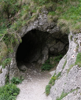
Shiprock is so unique that description is unnecessary. A total stranger would give it the same name, or something similar.
 In the same way, and for the same purpose, Mormon included landmarks in his record of the Book of Mormon. These were not spiritually related references, but were intentionally included by Mormon for geographical clarification. He refers to landmarks such as the Narrow Neck of Land, the Narrow Pass, the Sidon River, the Narrow Strip of Wilderness, the Waters of Mormon, the Valley of Helam or the Valley of Alma. Just as in the examples above, these landmarks should be easily understood geographical features that can be recognized by the average observer. If one has to use his imagination to make the feature fit, it is probably not the correct landmark.
If a stranger, unfamiliar with the Book of Mormon story, should identify one of these Nephite landmarks, wouldn't it lend credence to the account? I have found several examples of this very thing. David McCullough, in his historical account of the building of the Panama Canal, titled Path Between the Seas, discusses alternative routes for the canal. One of these was the route through Nicaragua up the San Juan River, across Lake Nicaragua, and over the Isthmus of Rivas. In some respects this was actually the better route. In fact it is still being considered as an alternative to the Panama Canal. But back to McCollough.
He comments on this early rival to the Panama route:
"The Nicaragua system was the creation of Cornelius Vanderbilt, who became seriously enough interested in a Nicargua canal to hire Orville Childs, a highly qualified engineer, to survey the narrow neck of land between Lake Nicaragua and the Pacific. And in 1851 Orville Childs had the good fortune to hike into a pass that was only 153 feet above sea level. He had found a place, in other words, that was a full 122 feet lower than the summit of the Panama Railroad, and by 1870 no lower point had been discover anywhere else." (Emphasis mine. From the book The Path Between the Seas: The Creation of the Panama Canal, 1870-1914, by David G. McCullough, p. 38-9)
McCullough has correctly recognized that the Isthmus of Rivas is truly a “narrow neck of land”, a conclusion that any impartial observer could also reach. Mormon's reference to this landmark is indeed a universally recognizable characteristic of the geography. In fact I would venture the guess that it is one of the few coastal features in the Americas that could be considered a “narrow neck.”
Another example: Several times Mormon's abridgement refers to a “narrow pass” which is associated with the narrow neck of land. Many researchers have speculated variously that this could be a narrow pass in a mountain range, a natural gorge, a narrow valley, or even a narrow shoreline. At the south end of the Isthmus of Rivas the coastal mountains extend almost to the shore of Lake Nicaragua. There, where the Sapoa River flows into the lake, it forms a narrow valley enclosed by encroaching hills. This river valley, and the adjacent Lake Nicaragua shoreline, was the ancient route of travel in pre-columbian times. I suggest that it was the “narrow pass” referred to by the prophet Mormon in the Book of Mormon.
The prominent archaeologist Frederick Lange (who as far as I know has no knowledge of the Book of Mormon) makes the following comment about this valley: "When I first conducted research in northwestern Costa Rica..., I was looking for Palioindian remains in the Rio Sapoa-Bay of Salinas area. I had picked this narrow ... corridor as part of a natural passageway leading from southern Mesoamerica to northern South America." (Emphasis mine. From An Archaeological survey of the Rio Sapoa Valley: Report on a preliminary season of archaeological research in northwestern Guancaste Province, the Republic of Costa Rica, 1969 Frederick W. Lange)
So here we have two independent observers who have possibly identified Book of Mormon landmarks without realizing that they were doing so. Perhaps we need to reconsider our theories.